
Start a Randolph County Property Records Search
Match the tool to the question. An address or owner name goes first to the West Virginia Property Assessment search. That search returns a county parcel ID, the displayed owner, mailing and physical addresses, a legal description, and appraisal fields. It also gives a deed book and page reference. Take the book and page to the Randolph County Clerk. Transfers, liens, and plats live there. The Sheriff's tax pages cover payment status, delinquency, and land-sale notices. The WV Property Viewer adds a map view, a flood layer, and spatial search.
That order cuts down false matches. Randolph County mixes dense town lots with rural tracts. Those tracts are described by acreage or metes and bounds. Keep the exact parcel ID and book/page close at hand. As you move between systems, keep one thing in mind. A tax card is a snapshot. A deed is a recorded instrument. A map line is a visualization. None alone is a title opinion or a survey.
- Search the state assessment site by Randolph County and street name, or use an owner name or full parcel ID.
- Save the district, map, parcel and suffix, plus the Owner(s), mailing address and legal description.
- Use the deed book/page or party name in the County Clerk's land-record index to check the transfer.
- Review the Sheriff's tax status and the WV Property Viewer when tax balance or parcel geography matters.
- Ask the custodian for an office copy when an image, certified document or older record is not online.
Where Randolph County Keeps Property Records
Randolph County property records live in three offices. The state supplies the shared search and map tools. The County Clerk is the recorder for deeds and related instruments, and its public page lists some records reaching back to the late 1700s. Public terminals are open on business days from 8:00 a.m. to 3:30 p.m., while the office itself lists weekday hours of 8:00 a.m. to 4:30 p.m. The Assessor keeps the tax roll. The Sheriff collects real estate taxes.
Randolph County Assessor
Owner, legal-description and appraisal questions
304-636-2114
Randolph County Sheriff, Tax Office
4 Randolph Avenue, Suite 100, Elkins, WV 26241
304-636-2100
Randolph County Deed Search Has Three Access Routes
The Clerk's land-record page lays out three routes. A free courthouse terminal is the first. LAREDO offers prepaid monthly remote access. Fidlar Tapestry serves occasional users who pay per search. Both remote systems run around the clock. The Clerk does not publish current prices on the access page, so check its instructions before budgeting for an image or search. Older books, certified copies, and record questions belong with the Clerk rather than guesses from a search result.
The Randolph County Clerk's land-record access instructions show the terminal and remote-search choices. Both routes reach the same county records.
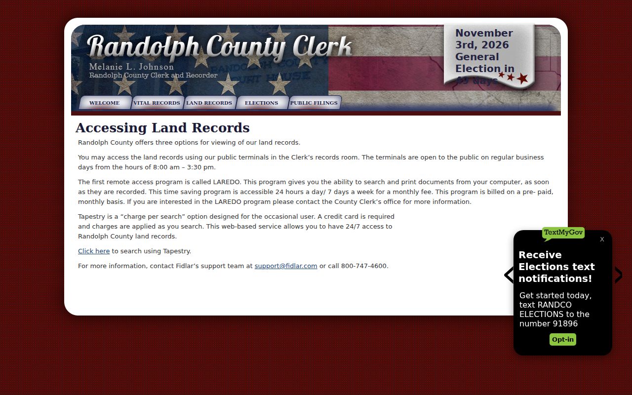
Choose the courthouse terminal when you need help moving from an index entry to an older book or image. Remote access is easier. Each service carries its own payment model.
What a Randolph County Assessment Card Connects
West Virginia's assessment search takes a wide range of keys. You can query county, district, full parcel ID, owner, map number, street name, property class, tax class, sub-parcel, or land use. Advanced filters narrow by appraisal range, acreage, sale date and price, flood hazard, mailing address, deed book and page, legal description, and building details. Search with the street name alone. The official help warns that situs addresses can be incomplete.
The sample detail card separates Owner(s), Mailing Address, and Physical Address. It also shows tax year, tax class, deed reference, deeded and calculated acres, legal description, land and building appraisal, flood display, sale history, and parcel history. One row can list a single owner. Multiple people may hold the interest. The card comes from the West Virginia Randolph parcel detail.
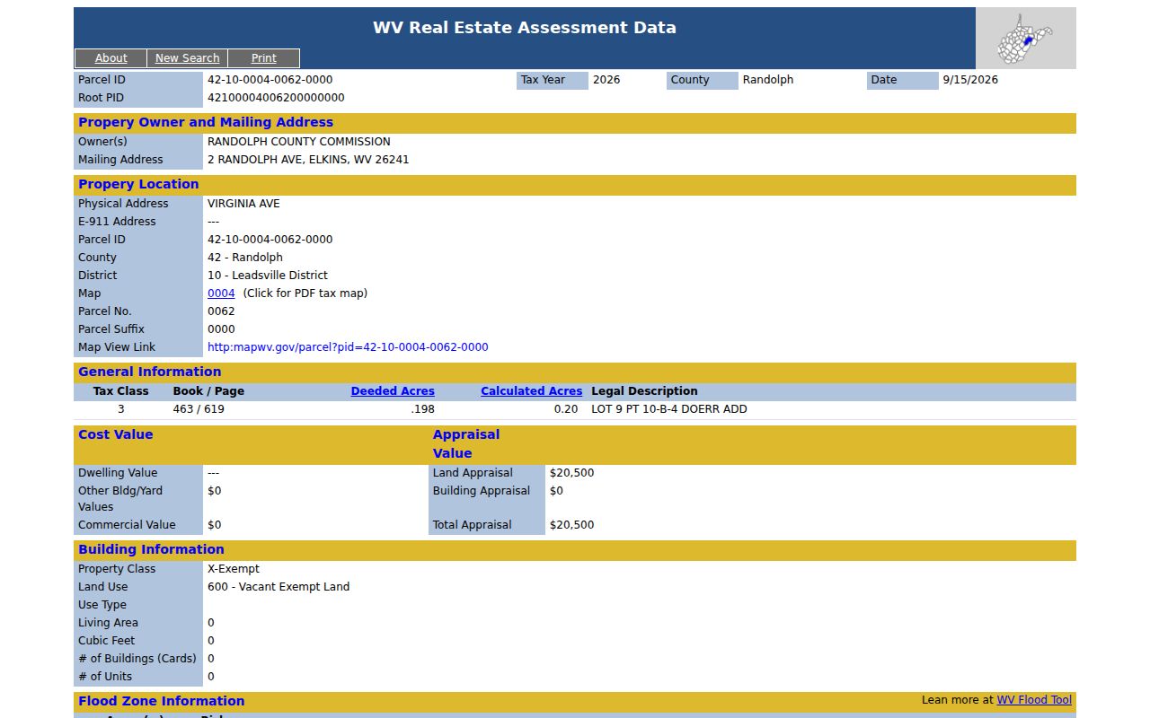
Here the physical address is Virginia Avenue, while tax mail goes to Randolph Avenue. Treat mailing location and land location as separate clues.
Randolph County Parcel Search Fields in West Virginia's Assessment Site
An uncertain address calls for more than one key. The Assessment site accepts an owner, a parcel segment, or a street name. Narrow next by land use, tax class, acreage, or appraisal. A parcel number works best once you know it. It is the strongest bridge to the Clerk's deed records and the GIS tools. Open the West Virginia Property Assessment search. There you can compare Randolph County, owner, street, and parcel filters. The screen shows the search form itself. It is not a result for one property.
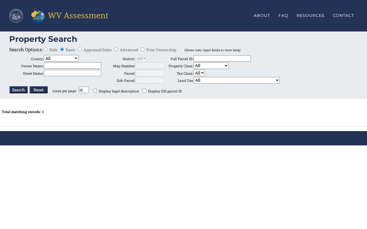
Choose Randolph County first. If the full address fails, try the street name alone. A parcel ID or a district and map number can narrow the next pass before the detailed card opens.
| Search field | How it narrows a Randolph record | Best use |
|---|---|---|
| County / district | Selects Randolph and a local district | First filter for a known location |
| Owner name | Finds the displayed owner entry | Entity or person name is known |
| Street name | Matches the street without relying on a full address | Address text is incomplete |
| Parcel / sub-parcel | Narrows to the numbered tax unit | Parcel ID is available |
| Book / page or legal description | Connects the card to a recorded reference | Confirming the deed trail |
The search form lives at West Virginia Property Assessment Search. Its fields find assessment records. They do not replace the Clerk's recorded instrument.
Record Types Behind Randolph County Property Records
Each record type tells part of a parcel's story. The County Clerk preserves instruments and plats. The Assessor's tax card identifies the assessed parcel, the Sheriff handles current taxes and delinquency, and statewide mapping tools display parcel geometry. City permits add construction and zoning context inside municipal limits.
| Record Type | What It Documents | Kept By | Access |
|---|---|---|---|
| Deeds and plats | Recorded transfers, legal descriptions and mapped lots | County Clerk | Terminal, LAREDO or Tapestry |
| Liens and releases | Recorded claims, satisfactions, easements and trustee sales | County Clerk | Land-record index and copies |
| Assessment card | Owner display, tax class, appraisal and parcel history | Assessor / WV Tax Division | Free public search |
| Tax payment and delinquency | Current bill, milestones and land-sale notices | Sheriff as Treasurer | County tax links |
| Parcel map and permits | GIS geometry; city work and zoning records | WV Viewer / municipality | Free viewer; city request |
Each record question has a natural home. Deed transfers start with the Clerk's index. Tax bills and delinquent balances sit with the Sheriff, while value questions begin at the Assessor's parcel card. The Randolph County deed-record guide covers recorded instruments in depth, and the tax page tracks bill dates and payment status.
Randolph County Property Tax Records Follow a Yearly Calendar
Randolph County's tax year runs on a fixed calendar. The Sheriff doubles as county treasurer and publishes the real-estate tax schedule. Current-year bills go out July 15. The first-half discount ends September 1, and that half turns delinquent October 1. The second half repeats the rhythm. Its discount closes March 1, delinquency starts April 1, and after April 30 unpaid accounts face publication and added fees. The land sale arrives each October. Use the dates as checkpoints only. For a parcel-specific status, the tax office sits at 4 Randolph Avenue, Suite 100, Elkins, WV 26241, phone 304-636-2100. Redemption may follow a sale, and the State Auditor manages that period, so confirm any parcel's deadline with that office. The Sheriff's real-estate tax page is the official calendar, and it helps tell a current bill from a delinquent-land or sale notice.
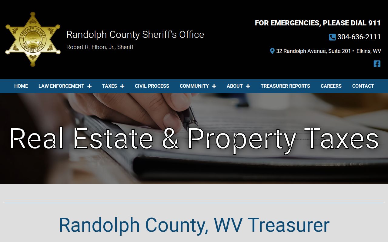
The State Auditor handles redemption. That office keeps the delinquent and nonentered-land records, so check any notice against both the county tax file and the state file.
Randolph County Parcel Records on the WV Property Viewer
The statewide parcel viewer layers county parcels over tax-district boundaries. It also adds address labels, flood data and basemaps. Click a parcel at close scale. The detail panel can show the owner of record, physical address, building details, cost and appraised values, and the legal description. Geometry search works with a point, rectangle or polygon plus a configurable buffer. Results stop at 1,000 records.
The map is handy for spotting adjacent parcels. It also helps with moving from a street to a Parcel ID. It is not a survey. The Viewer itself notes that GIS acreage is an estimate and deeded acreage governs assessment. Its help page also covers print, share, bookmark, measure, buffer and CSV export tools.
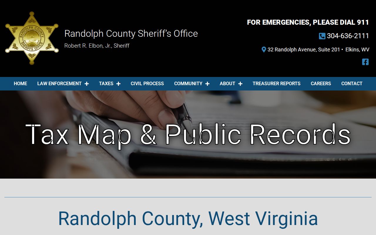
Open the countywide parcel view at WV Property Viewer. The map below shows tax-map record links from the Randolph County Sheriff tax-map page.
Trust the plat, not the pixel. When a line affects a purchase, fence or building plan, a recorded plat or survey settles it; map geometry is a lead to the authoritative land record, not the final boundary call.
Randolph County's Older Land-Record Trail
The County Clerk says some records date to the late 1700s. That gives Randolph County a long deed-book trail, but it does not establish that every old volume is searchable online. A library-hosted tutorial describes an old index-book workflow covering 1776 through 1947, with separate grantee and grantor lists, page-turn arrows and a later book/page lookup. The tutorial's system identity and Randolph-specific online cutoff have not been confirmed, so treat those years as a research lead and ask the Clerk before relying on them.
For a chain search, save the latest deed reference from the assessment card, read the grantor and legal description, then search that grantor as a grantee in the earlier index. Use the district, map, parcel, subdivision, lot and book/page fields to work through spelling changes or a rural metes-and-bounds description. Mark an unconfirmed gap instead of assuming two similar names refer to the same person.
Older local-history work can also begin with the Elkins-Randolph County Public Library and the Randolph County Historical Society, whose appointment-based research collection is described in the county research sources.
Request a Randolph County Record That Is Not Online
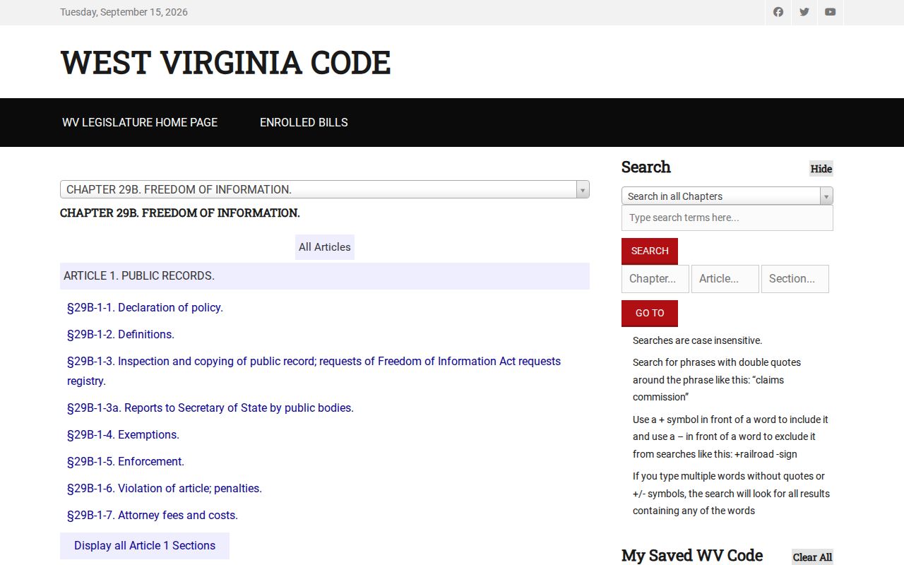
Start with the office that holds the record. The Clerk's land-record service is the direct route for deeds and plats. Owner, address or parcel corrections go to the Assessor. Tax account questions belong to the Sheriff. For other public agency records, West Virginia's Freedom of Information Act applies. A request must describe the records with reasonable specificity. The custodian must respond as soon as practicable and no later than five days, excluding Saturdays, Sundays and legal holidays. That response means copies, an inspection or copying appointment, or a written denial with reasons and review information. Fees can cover actual reproduction costs. Search and retrieval labor cannot be charged. Nor must an office build a new database or reach a legal conclusion. The West Virginia FOIA text is the official reference for the timing and cost rules.
An office's own form often beats a general request. Include the parcel ID, names, record type and approximate date range whenever you know them.
Town and City Files Add a Local Building Layer
Randolph County assessment files, deed records and GIS maps form the shared parcel framework. Municipal offices keep the local permit, inspection and zoning material. Elkins publishes a four-page building-permit application plus a separate zoning application. The city offers no searchable permit-results database, though. Its forms ask for the owner of record, job site, contractors, work details and district-map-parcel information. Zoning review also calls for a site plan. Mill Creek lays out permits, inspections, occupancy certificates, fire prevention and plan review. It sends applicants to forms or the town office rather than a public address search.
Beverly works differently. Local-history sources and council material add context, but the town publishes no online permit index. A postal city name does not settle whether a parcel sits inside a municipality. First save the county Parcel ID and compare the map or municipal boundary information. Then ask the city or town for the relevant permit or code file. Match that file back to the assessment card and the recorded deed. A permit documents municipal work, not ownership.
Limits of a Randolph County Property Record
An assessment owner entry is just the name on a tax record. It is not proof that every interest has been found. The drawn parcel edge on a GIS map is not a boundary survey. A sale price records one past transaction, not a current appraisal. A recorded deed supplies an instrument reference. A complete title review may also require liens, releases, court orders, estate filings and older deed records.
Lawful use. Randolph County property records support property research, purchase diligence and civic review. They do not replace a title search or licensed survey, and public owner details must never be used to stalk, harass or harm another person.