
How a Randolph County Property Search Moves
Start at the West Virginia Property Assessment site. That portal covers Randolph County property records. It also searches by county, district, owner name, street name, parcel segment, or full parcel ID. If a full situs address fails, try the street name alone. Address text in the data can be incomplete. Once a parcel card opens, write down the formatted ID, owner, mailing address, physical address, legal description, and book/page reference. Then move on.
A good property search is really a trail across offices. Assessment data pins down the tax parcel and the displayed owner. The County Clerk's index holds the deeds and other recorded instruments. The Sheriff reports taxes and delinquency. The WV Property Viewer adds map geometry and location context. Keep those roles separate. Treating one result as a full history is the fastest way to go wrong.
- Choose Randolph County, then search by owner, street name or the known parcel segment.
- Open the likely card and compare the physical address, legal description and district before accepting the match.
- Record the parcel ID and deed book/page; use the party name or reference in the County Clerk index.
- Check Sheriff tax status and the WV Property Viewer when unpaid tax or parcel geography matters.
- Ask the custodian for a copy if the search result does not include the instrument or image needed.
Randolph County Assessment Search Fields
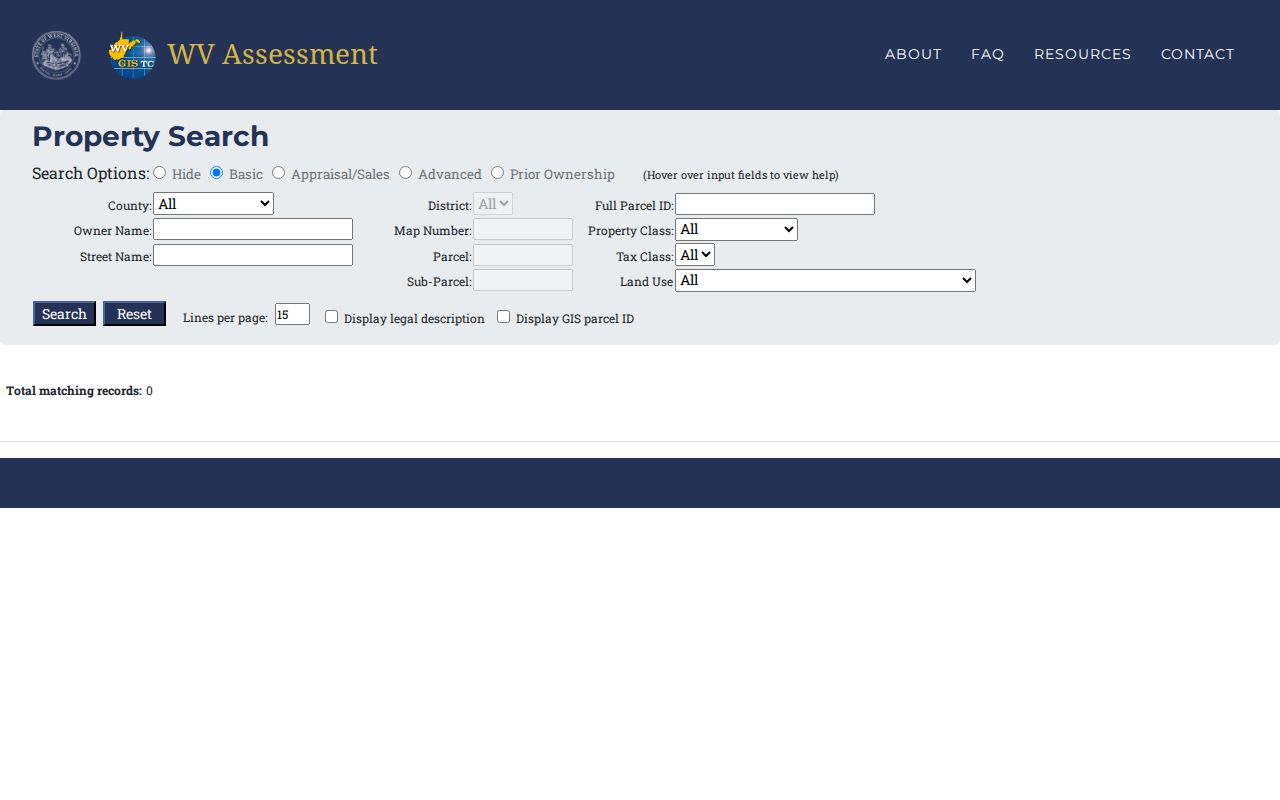
The state form gives you enough filters to work from a partial clue. Basic fields cover county, district, full parcel ID, and owner name. They also cover map number, property class, street name, parcel, tax class, sub-parcel, and land use. Advanced filters narrow things by appraisal, acreage, sale date and price, mailing address, legal description, deed reference, building age or area, flood hazard, and structure count.
Go broad first. Then narrow. A rural owner may hold several parcels under similar names. A map or parcel number can help separate them. The field inventory here matches the controls in the Randolph County assessment search.
| Field | Type | Use or format note |
|---|---|---|
| County / District | Dropdown | Select Randolph and a local district |
| Full Parcel ID | Text | Enter the complete West Virginia parcel identifier |
| Owner Name | Text | Supports an owner-name search |
| Map Number / Parcel / Sub-Parcel | Text | Use known parcel segments |
| Street Name | Text | Street only is useful when an address is incomplete |
| Property Class / Tax Class / Land Use | Dropdown | Narrow by assessment category |
| Min/Max Land, Building, Total Appraisal | Numeric | Filter appraisal ranges |
| Calculated / Deeded Acres | Numeric | Separate GIS estimate from deeded acreage |
| Sale From / Through; Min/Max Price | Date / numeric | Limit sale-history results |
| Flood Hazard / Mailing Address | Dropdown / text | Advanced filters |
| Deed Book / Page; Legal Description | Text | Bridge assessment and Clerk references |
| Building Year / Area; Structure Count | Numeric ranges | Filter improvements |
| Legal description / GIS ID display; Lines per page | Checkbox / numeric | Control result display |
Use the official West Virginia assessment search for the live fields. The form displays county, owner, street, and parcel options plus the advanced filters.
Filters are search tools, not proof. A blank address or missing owner row can simply reflect how the source record was entered.
Carry a Randolph Parcel Into the Clerk Index
The Randolph County Clerk's public index is a separate system from the assessment form. Its search modes include Individual, Firm, Book & Page, Instrument, Description, and Date Range. Individual searches split last, first, and middle names, while Firm uses a single name field. Description searches draw on tax map, subdivision, lot, and block. They also cover township, quarter, section, town, range, and acreage. A deed search lands best when the parcel card supplies a reference. It also helps to have a legal description.
The portal offers Index Search, Image Search, and Vault Indexes. Export and help controls sit alongside them. It can locate a recorded instrument, but images travel different routes. Those routes are courthouse terminals, monthly LAREDO, or per-search Tapestry. The Clerk's current instructions list the fees, so check them before paying.
What a Randolph County Parcel Card Shows
The state detail card is more than a name and a value. It ties an owner display to a tax year, district, map, parcel, and suffix. It also carries the mailing and physical address, a legal description, deeded and calculated acreage, appraisal components, a flood display, sales history, and year-by-year parcel history. Grab the book/page reference. It is the handoff to the Clerk's deed records.
| Owner(s) | Name displayed on the assessment row; other co-owners may not all show there |
|---|---|
| Mailing / physical address | Tax-notice destination and land location are separate fields |
| Parcel ID | District, map, parcel and suffix identify the tax unit |
| Appraisal | Land, building and total values by tax year |
| Legal description | Recorded lot wording or a rural legal description |
| Book/page and sale history | Reference plus available sale and parcel-history rows |
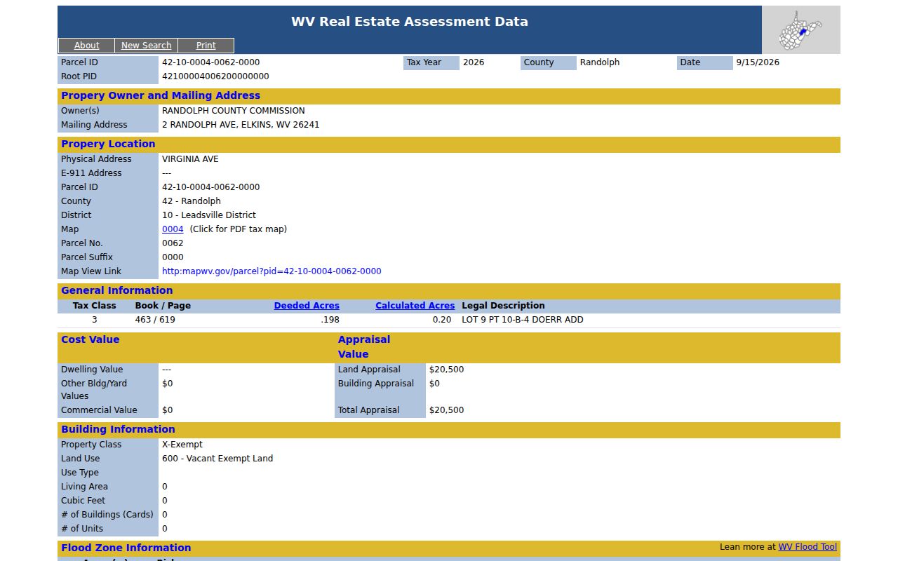
One sample Randolph card shows a Virginia Avenue physical location. It also gives a Randolph Avenue mailing address, plus the Leadsville district, map 0004, and book/page 463/619. The card describes "LOT 9 PT 10-B-4 DOERR ADD." It lists 0.198 deeded acres and 0.20 calculated acres. Details like these help you match the parcel. A street-address match is not always the right tract. GIS acreage is not always the legal acreage.
The sample Randolph County assessment card shows how those fields sit together.
Use the owner and the book/page reference as cross-checks. A tax record search can guide a deed search, but it is not a title search or a survey.
Choose the Randolph County Search Key That Fits
Address, name, and parcel number each answer a different need. A street is quick when it is stable. But the database may store only part of it. An owner name can return a whole group of parcels. Or it may return several people who share a name. A parcel ID is the closest thing to a shared key across Assessment, Viewer, and Clerk references.
WV's E-911 address search takes a street address, city, and state abbreviation. It does not accept rural routes or post-office boxes. For rural land, move to the assessment street-name or parcel path. The Assessment site itself advises using a street name alone where the full address fails. Before treating two matches as the same property, compare the legal description and the district.
Parcel means a unit on the tax map. Situs is the physical location, while the mailing address is where notices go. Owner of record is the name the assessment roll displays. It may differ from a full deed vesting review in the Clerk's deed records.
Randolph County Owner Searches Can Miss a Match
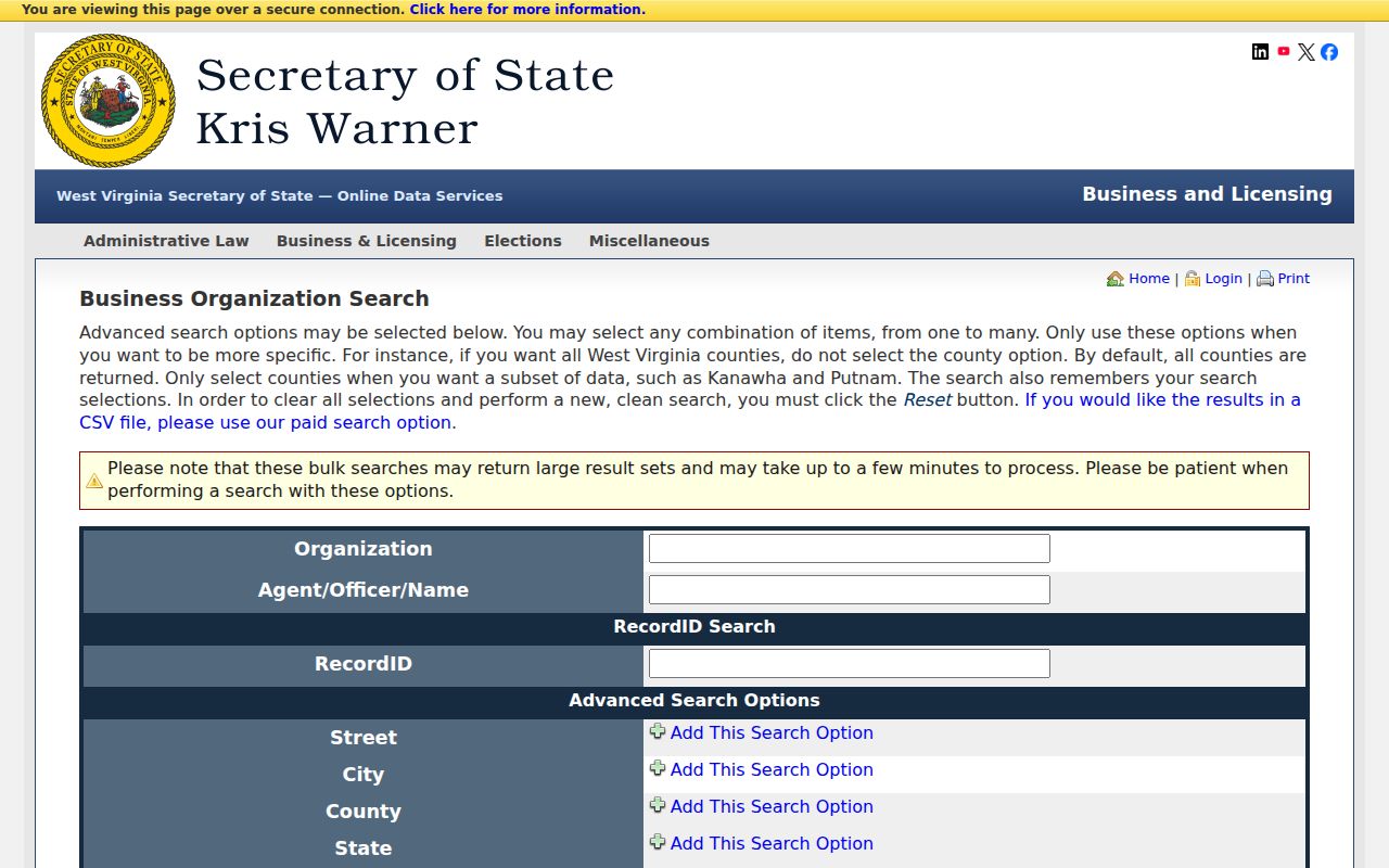
A partial name rarely points to just one owner. Randolph County assessment rolls print people last name first. A firm may appear only under the exact LLC or trust wording written into the deed. An estate may sit on the roll during administration. When an entity shows up, the West Virginia business organization search can reveal its registered agent or address, though it never proves the entity holds the Randolph County parcel. That confirmation belongs to the deed.
The Clerk index searches by party name, firm, instrument number, or legal description. Use it when the card shortens a firm name. Compare grantor and grantee on the deed against the current assessment card. Then look for a later transfer. A result list is a start, not a full roster of every ownership interest. Treat it that way. The advanced search page includes Randolph as a county filter alongside its other controls.
Go back to the deed and assessment record for the true property link. A listing alone proves neither ownership of the Randolph County land nor any right to act for it.
Keep Every Randolph County Parcel ID Segment
Randolph County's sample parcel reads 42-10-0004-0062-0000. Each segment means something. County, district, map, parcel, and suffix cross-link the assessment card, the map tools, and the deed. Keep every leading zero when you copy the ID. A trimmed string can point somewhere else entirely. It may simply fail to match the card at all.
Record the ID next to the owner, physical address, legal description, and book/page reference. The state assessment search accepts the parcel directly. The Viewer can locate its mapped outline. The County Clerk can pull the instrument by book, party, or description. Still, the ID cannot replace the legal description when two Randolph County parcels look alike.
Use Randolph County Street and E-911 Searches Differently
Street and E-911 searches serve different jobs. The statewide E-911 tool takes a street address, city, and state abbreviation. It refuses rural routes and post-office boxes. So it fits when you know the physical spot. The Randolph County assessment search, by contrast, has its own street-name field. Its help advises entering the street name alone when an address will not match, since situs entries can be incomplete.
A mailing city may not govern the land. Once a result appears, compare the physical address, tax district, and parcel ID instead of trusting the postal label. If both address routes fail, try the owner or the full parcel number. Then let the deed's legal description settle the match.
When a Randolph County Map Search Has No Geometry
A missing outline does not erase the record. The statewide Viewer may warn that a parcel has no geometry. A broad spatial search can hit its 1,000-row limit. Zoom in to about 1:18,056 or nearer. At that scale, parcel edges become clickable, and stacked parcels may share one popup. Narrow your shape first. Drawing a tighter point, rectangle, polygon, or buffer should come before any conclusion that the property is absent.
When the map yields nothing usable, pull the formatted parcel ID, tax district, and legal description from the assessment card. Then check the Clerk's instrument or plat. A map search locates tax geography, not surveyed lines or legal ownership.
Search Randolph County by Address, Owner or Parcel
Match the key to what you already know. An address works when the situs is clear, an owner name when ownership is the clue, and a parcel ID when a card or tax map supplies it. If the first try fails, switch keys. Repeating the same query rarely changes the answer. The right match should agree on district, legal description, and street text.
| Search Key | Best For | Where It Works | Watch Out |
|---|---|---|---|
| Street name / address | Find the location when the address is known | Assessment, E-911 or Viewer | Assessment text may be incomplete; avoid PO boxes |
| Owner or firm name | Locate a displayed tax owner or recorded party | Assessment or Clerk index | Same names, partial values, LLCs and trusts can split results |
| Parcel ID / book-page | Match one tax unit or known instrument | Assessment, Viewer and Clerk | Preserve leading zeroes and all parcel segments |
Not a title search. A Randolph County property search locates assessment and recorded-index entries; it does not guarantee clear title or reveal every unrecorded interest. Use the Clerk's instruments and a qualified title professional when ownership certainty matters.