
Begin a Mill Creek Property Records Search
Begin with the street address in West Virginia Property Assessment. If the full address fails, fall back on the street name, owner name or parcel attributes to land on a likely card. Write down the district, map, parcel and suffix. Those numbers open the County Clerk index for the deed or plat. The Sheriff's tax links cover payment details. The WV Property Viewer adds helpful map context. When construction or occupancy history matters, Mill Creek's permit and inspection office holds that layer.
- Search Randolph County Assessment by address, street, owner or parcel segment.
- Copy the parcel ID and legal description, then check the County Clerk's deed index.
- Use the Sheriff for tax payment or delinquency and the Viewer for map context.
- Request Mill Creek permits, inspections or occupancy records through the town's published channel.
- Confirm that the parcel lies within town limits before applying municipal code information.
The Randolph County property-search route lays out the county lookup mechanics. Mill Creek's municipal records are an extra request, not a second assessment roll.
Where Mill Creek Property Records Are Kept
Most of the parcel's paper trail sits with the county. Deeds, assessment, tax status and GIS ownership data all live in Randolph County offices. Mill Creek separately runs a Building Permits and Inspections Department and coordinates with its Planning and Zoning Commission. The split matters. A town permit may explain a structure or an occupancy event, but the County Clerk's recorded instrument remains the true ownership source.
Randolph County Parcel Records
The county holds Mill Creek's deed, assessment, tax and parcel-ownership records.
Mill Creek Permits and Inspections
Town office request; direct phone and fee sheet were not confirmed in the research.
Mill Creek Building Permits and Inspections
The town's Building Permits and Inspections Department handles construction inspections, permits, certificates of occupancy, fire prevention, special events and building-plan review. It works alongside the Planning and Zoning Commission. Residential and commercial applicants get forms through the town page or by calling the office. The page does not offer a searchable list of permit results. It also lacks a public address filter.
The screenshot links to the official Mill Creek permits and inspections page. It documents the department's responsibilities rather than a live permit-search interface.
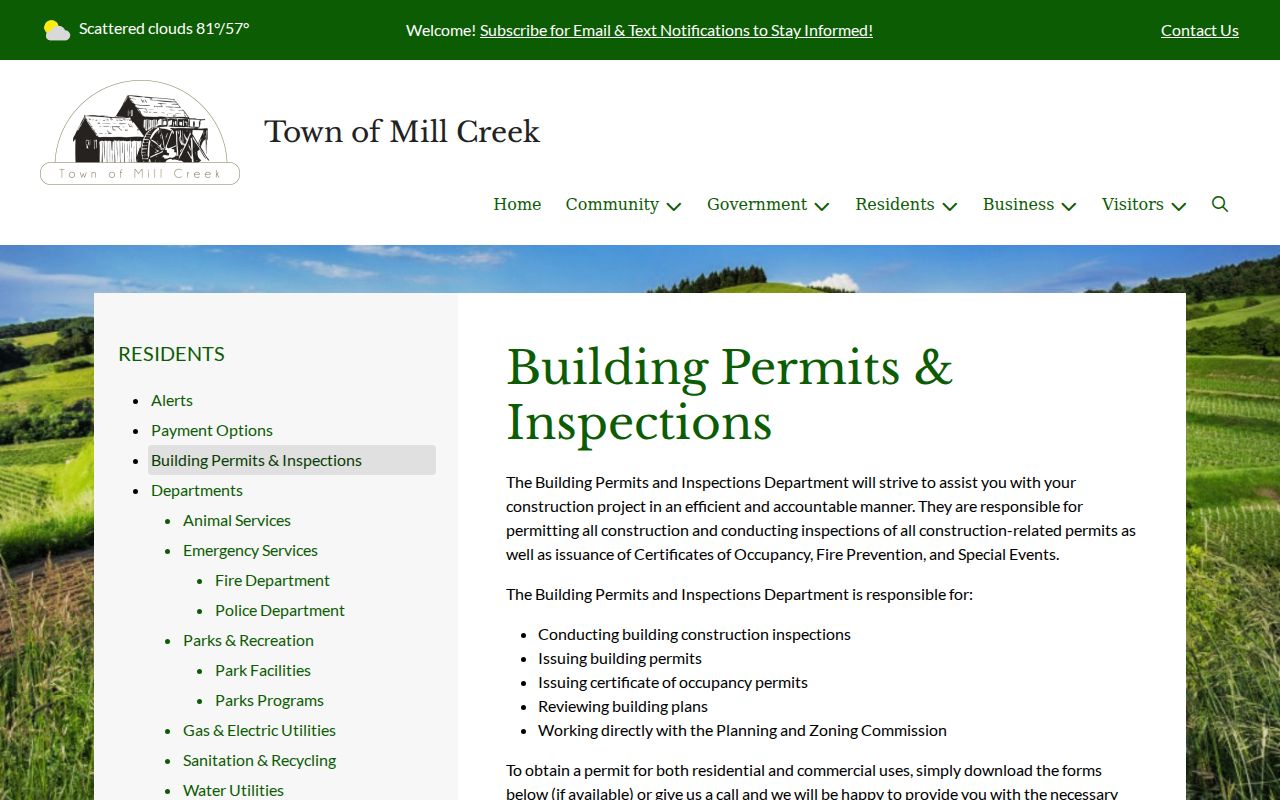
Current permit fees, a direct phone line, form fields, coverage years and historical results are not published there. Ask the town directly before assuming an online entry is missing.
Request a Mill Creek Permit or Occupancy Record
No public portal lets you search by address or permit number. Start instead with the town's published page to download forms or contact the office. Give the job-site address, parcel reference, work type and an approximate date range if known. Clarify whether the record is a permit, inspection, certificate of occupancy, fire-prevention item or planning matter. That detail routes the request to the right file.
Once the municipal record arrives, compare it to the Randolph County assessment card. Match its address and parcel reference to the assessment card's own entries. A permit description documents planned or approved work. It does not prove the work was finished or that ownership changed.
The town may hold a responsive public record that is not posted online. If so, a reasonably specific written request can name the property, file type and time period. West Virginia's FOIA sets a five-day response deadline, excluding Saturdays, Sundays and legal holidays. Any charge may cover reproduction costs, not search labor. Ask the town for the current request route before relying on an old schedule. Confirm the current copy cost too.
Mill Creek Planning and Zoning Coordination
Per the town's official page, permit work coordinates with the Planning and Zoning Commission. Inspections do too. Municipal code materials also name development, planning and code-enforcement categories. No standalone zoning-map URL or public search portal is published. A parcel-specific jurisdiction question belongs with the town office, not an unverified map.
A certificate of occupancy is a municipal record, distinct from the County Assessor's card. For a recent addition or use change, request the town record. Request the county parcel history too. Read together, they explain what changed. Neither file alone is the complete property history.
Mill Creek Lots and Subdivision References
Named Mill Creek subdivisions are not published in a verified form. Plat-book references and development eras are not either. That gap should not be filled with countywide place names. Use a County Assessor parcel ID instead. Then search the County Clerk's Description fields for subdivision, lot, block, tax map and book/page. Older or irregular tracts may rely on metes-and-bounds wording rather than a named plat.
| Neighborhood / Subdivision | Era | In the Records |
|---|---|---|
| Named subdivisions | Not verified | Use County Clerk subdivision and book/page fields |
| Town lots or plats | Era not established | Match lot/block wording to the tax-map parcel |
| Rural or irregular descriptions | Not a subdivision | Search legal description, acreage and map segments |
When a plat turns up, compare its lot lines with the county GIS. The recorded description remains the legal reference. The Randolph County parcel-map guide explains the limits of the mapped outline.
Mill Creek's Small-Town Parcel Search
Mill Creek is an incorporated Randolph County town of about 560 residents. That figure comes from the 2020 Census place table. The county property records system covers the whole municipal area. Street addresses here can look rural or incomplete. A first query may come up empty. When that happens, rotate among E-911 address search, street-name search, and parcel attributes. Repeat until the parcel appears. Save the Parcel ID and legal description. A town label alone will not hold up in county property records.
The county-to-town workflow matters most. County property records establish the parcel and its recorded land description. The town adds permit and inspection context. Tie any permit request back to the same county parcel first. The work history then stays connected to the right property.
Mill Creek Mailing City and Town Boundary
A Mill Creek mailing city proves nothing about location. The town publishes no complete annexation history, boundary-change map, ZIP-crossing list, or E-911 readdressing project. So treat the mailing city as a postal label only. Never treat it as proof that a parcel sits inside town limits. Check the community and parcel layers on the county map. Then ask the town clerk whether municipal permit and zoning jurisdiction applies.
This matters most near the town edge. A post-office address can serve nearby unincorporated land there too. The county parcel ID stays the stable key while a boundary question gets confirmed.
Mill Creek Values in Randolph County Assessment
Randolph County publishes no town-specific revaluation report or value trend for Mill Creek. The assessment card is the source that counts. It carries the tax year, tax class, land, building, and total appraisal, plus acreage. It also covers sales and parcel history. Compare numbers using the card's tax-year label. A municipal permit page sets no market value.
Pair a town permit or occupancy file with the county card. That helps whenever an improvement might explain an appraisal change. The county Viewer separates deeded acreage from a GIS estimate. That distinction matters for irregular or rural Mill Creek parcels. And remember: a past assessment or old transaction is not a current appraisal.
The assessment system here is the same one used across Randolph County. Search it by owner, street, district, map, parcel, or tax class. The detail card lists mailing and physical addresses separately. Mill Creek's 2020 Census count of 560 residents is not a parcel count. It is not a permit total either. For a property's value, read the actual tax-year card. For building work, go to the town's file.
Limits of Mill Creek Property Records
A town permit page is not a searchable ownership register. A county assessment card misses some municipal inspections. The GIS boundary is not a survey. The town publishes no searchable permit fields, fees, or historical index, so contact the office directly for a record rather than assuming a null result means no permit existed.
For ownership and tax details, rely on the county deed records and assessment record. Then pull the municipal permit or code file to understand building work. Keep every request tied to a parcel number. Verify jurisdiction before leaning on a town record.
What Mill Creek Property Records Show and Their Limits
Mill Creek property records blend county ownership, assessment, tax, and map sources with a town layer for permits, inspections, and occupancy. Each source stops somewhere. A permit is not a deed. A tax card is not a title opinion. A mapped parcel edge is not a survey. Match everything by Parcel ID, legal description, and verified municipal jurisdiction.
Lawful use. Mill Creek records support property diligence and public-interest research. Never use owner information to stalk, threaten, harass or harm a person.